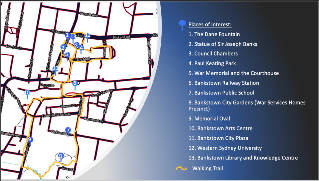
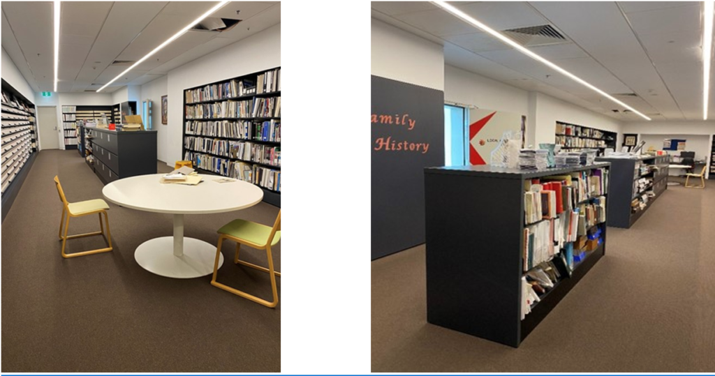
My public history project is an interactive QR-coded walking tour of the Bankstown C.B.D. area in collaboration with the Bankstown and Campsie Library. Throughout the production of my project, I worked closely with the Local Histories Librarian, Jennifer Madden. I have been working closely with Jennifer over the past few months. I have thoroughly enjoyed being able to help my local library with the reorganisation and refiling of archival material and images for their possible new pictorial database. Their current system for their pictorial database (Pictorial Canterbury) had many issues with duplicates, missing images, irrelevant files, and their quality. I helped sort through and deciphered which images needed to be deleted and which ones had missing numbers, and I reassessed the quality of the photos. We discussed the significance of presenting Bankstown’s rich local history in a new and innovative way to reach a broader public audience. We concluded that an interactive walking tour was the most appropriate for my project and (most importantly) the organisation’s needs.
During the production and research process for the historical walking tour, I realised that many sites around the area had historical value. Although I have lived in the Canterbury-Bankstown area my whole life, I never knew about the rich history some of these sites possessed. I would regularly pass by them on the commute to work, my daily walks, and even on the way to grocery shopping. In that sense, it would be perfect for highlighting the unrecognised historical value of these sites most people in the community pass by daily.
My main argument for this project was to highlight the importance of showcasing local histories in new and engaging ways to prove that history can be taught beyond the bounds of the classroom. Sites around your local community area all encompass rich and long past. They tell stories of past communities, interactions and social hubs and show how History can connect people outside the classroom.
Some of the recurring themes within my project include the importance of relaying local histories and making them accessible and inclusive for a broad audience. In addition, the non-static nature of this project allows for local sites and the evolving history of different places to be recorded and displayed for the future.
I have chosen to present the walking tour via PowerPoint presentation due to the timeframe of this assessment and the rigorous process of receiving approval from Council officials. Therefore, my project is presented in a PowerPoint presentation with external links to different pdf files, which will be saved onto a USB. Initially, I wanted to publicise this walking tour online on an external website for easier access. However, this format was chosen because of Canterbury Council’s restrictions with promoting information under their name. This file will be given to the Local Histories Librarian I am working closely with and will serve as an example for future project proposals for interactive walking tours to be approved by Council officials. This project aims to be open-ended and remain dynamic as more sites can be added in the future.
This walking tour is unique due to its innovative presentation. It focuses on the local community’s inclusivity by adding different translations of information in the four primary languages of the Canterbury Bankstown Council (English, Korean, Arabic, and Vietnamese). This was, unfortunately, out of my area of expertise, so my final project does not include this aspect. However, my presentation for the library is intended to be not static and remain an open-ended project. More sites could be added in the future, and audio recordings of the tour would be added for broader accessibility and to suit the needs of people with disabilities. Its fluid format (given the approval of this proposal) is transformed from a project pitch to Q.R. codes displayed on signposts next to each site of interest, allowing people to enjoy this immersive experience in their own time.
