This project has taken a bit of a turn. Within my last blog post I have mentioned that I was thinking of creating a video for the Millers Point Community Resident Action Group. Well things can change quite unexpectedly. Prior to my previous blog post I was still waiting on the volunteer work that I would do for this organization. However, I received a phone call after I had just finished work, from the President explaining to me what I could do. This work would include collating a number of Conservation Management Plans of buildings around Millers Point that could be easily accessed by the organization. After a discussion with my mum on how I could use this as part of my project, it was deciding that I would create a walking tour of a number of sites using the information providing within these management plans. So the Millers Point Historical Walking Tour was born.
I had received a list on which management plans needed to be collected, however some of these I have been unable to collect, namely the more popular sites such as the Palisade Hotel and the Lord Nelson Hotel (that one has quite a story). After reviewing these management plans, I have learned a lot about Millers Point and The Rocks, particularly that of the Bubonic Plague Outbreak as well as the resuming of the many of the properties within Millers Point and The Rocks by the Sydney Harbor Trust.
For this walking tour I decided to go with 10 sites, where I would write a brief description of the history of the site. I included the history of sites that might not be as well known as hotels or pubs because I feel that these small terraces do hold a history of their own for Millers Point and The Rocks. Many of these terraces were built as rental properties by wealthy families such as the Merrimans, which helps reveal the property market and local economy of the late 18th and early 20th century. As well as this, these are the original homes that made up the streetscape of this era, helping show the original layout of Millers Point and The Rocks.
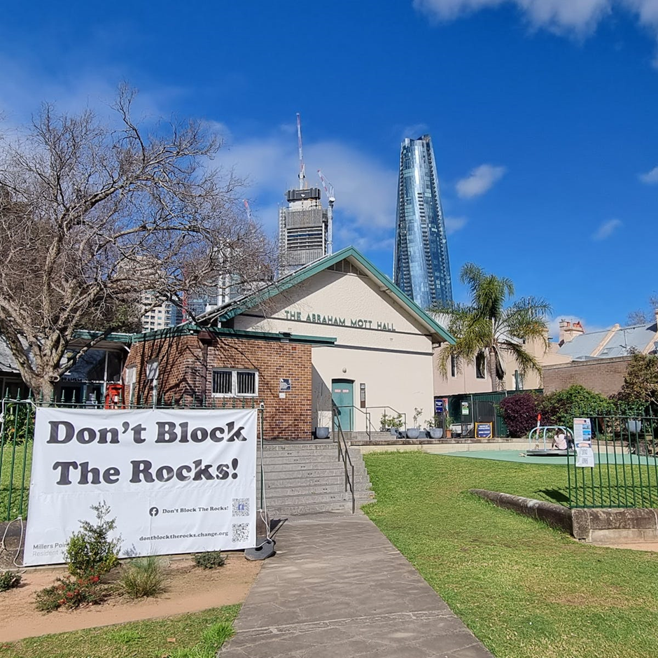
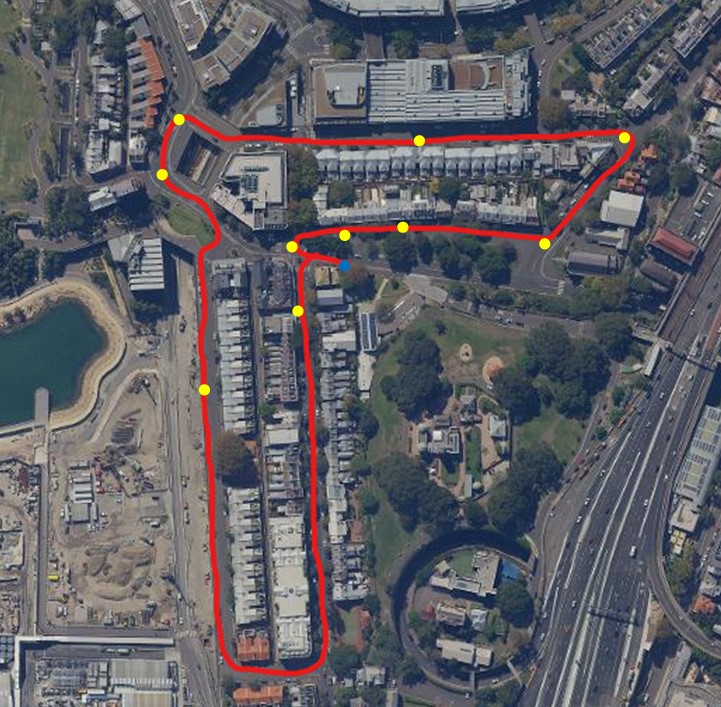
The route for this walking tour begins at the Abraham Mott Hall and continues as follows:
- The Lord Nelson Hotel
- Argyle Place Terraces
- Cole’s Buildings (23-32 Argyle Place)
- Garrison Church
- The Hero of Waterloo Hotel
- Windmill Street Terraces
- Dalgety Terraces (11-13 Dalgety Street)
- The Palisade Hotel
- High Street Terraces
- St Brigid’s Church
Included is a map of the route.
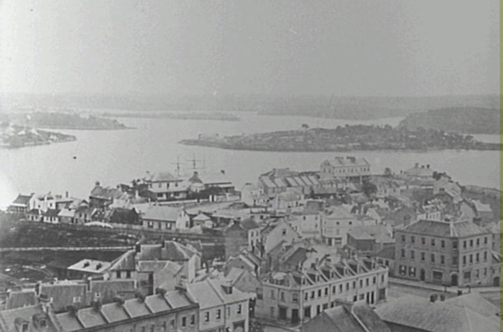
The only main challenges I experienced in the creation of this walking tour surround gathering information for the more well known sites as well as finding historical photographs. While the majority of information that has been used in these descriptions were found within the Conservation Management Plans, I had to search within the NSW Heritage Register. While not as detailed, it still provided me with enough information. The majority of photographs used within this project were found within the City of Sydney Achieves, the NSW State Library Collections and the Conservation Management Plans. However for some locations I was unable to find any photographs. As well as this, I couldn’t really find any ‘old’ photographs. Well I mean old as in older than 1980. While a few of these images pre date 1910, I feel I could have really better expressed this history through photographs from the time.
I have decided to create a printed pamphlet that contains this walking tour, where people can grab one from the community center and begin their journey. However I feel that this alone will not be a long term plan. To maintain the longevity of this walking tour, I have proposed an idea of having a QR code that can be scanned that will provide a digital version of the walking tour, however I have not heard back about this idea.
Ultimately, the driving force behind this walking tour is to help promote the use of heritage listing as well as maintaining the history of one of Sydney’s oldest suburbs. Particularly during a time of development and remodeling, this is a important location in helping express Sydney’s history. By maintaining Millers Point and similar suburbs, their history and stories continue to live. While not as grandeur as the historical towns found in Bendigo or the U.S, this can at least give us a glimpse of the past and the original streetscape that has remained (mostly) unchanged.